POINTR
Mapping Boreal Forest Change Using 3D Radar and Point Cloud Data
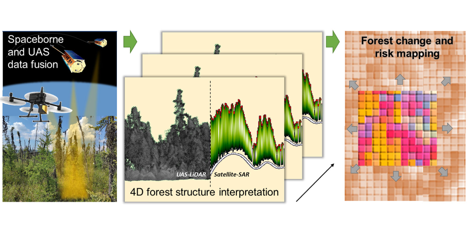
Climate change is accelerating structural shifts in northern boreal forests, with major consequences for carbon uptake, ecosystem health, permafrost stability, and biodiversity. Monitoring these changes in space and time, so-called 4D forest structure, can reveal forest condition, resilience, and the trajectory of ecosystem transformation.
However, current monitoring methods face serious limitations due to the low spatial resolution of remote sensing data and the scarcity of reliable 3D reference measurements.
POINTR addresses these gaps by fusing multi-temporal point cloud data and radar imagery with ecological expertise. This enables the detection of subtle forest structure changes and the identification of early warning signals for carbon loss, permafrost disturbance, and biodiversity risks.
To ensure broad impact and reusability of the change and risk information products, POINTR will also deliver an open-source, interactive web service that follows FAIR data principles.
Learn more on their dedicated webpage
Other projects
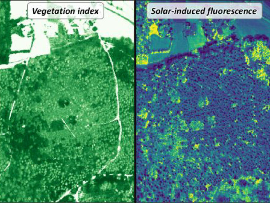
3DforestSIF
Understanding the solar-induced fluorescence (SIF) signal of natural, complex tree canopies
3DforestSIF seeks to correct airborne solar-induced fluorescence (SIF) data from forests for canopy structural and illumination effects, providing valuable insights for the early detection of forest stress.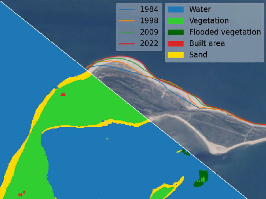
AutoCoast
Automatic detection of coastline change and causal linkage with natural and human drivers
Coastal erosion enhanced by climate change has become an increasing global threat, which requires rapid detection and reliable risk assessment. AutoCoast aims to provide advanced and reliable remote sensing-based AI tools to quantify coastline change rate at high-resolution and unravel the linkage between coastline change rate and natural and anthropogenic drivers at regional to global scale.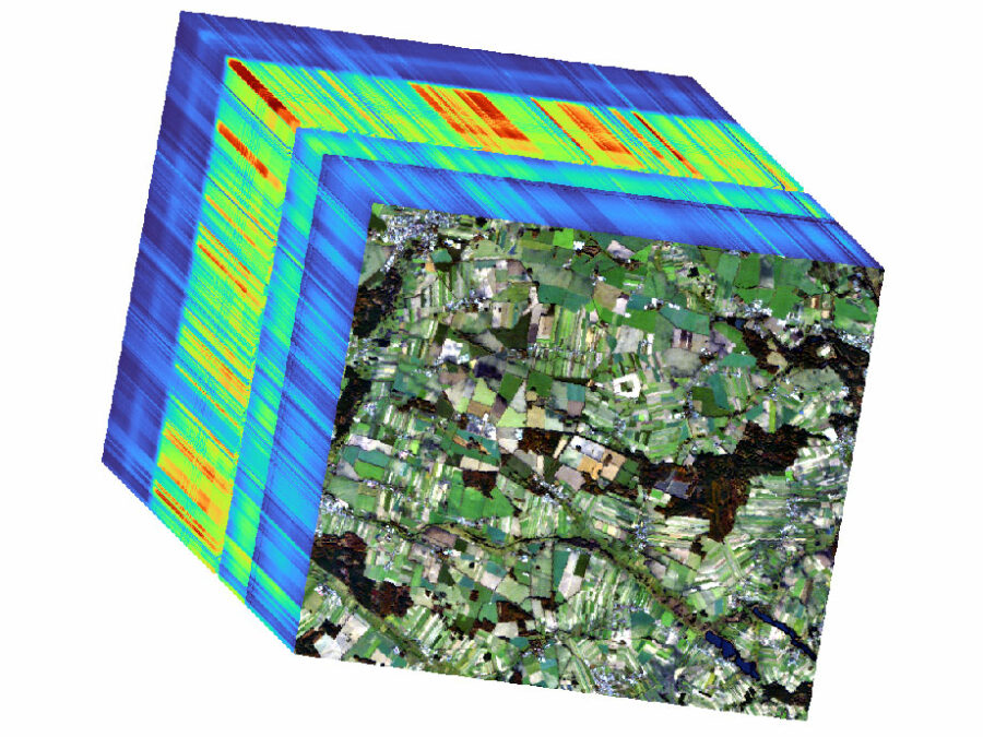
HYPER-AMPLIFAI
Advancing Visual Foundation Models for Multi-/Hyperspectral Image Analysis in Agriculture/Forestry
The project aims to make advanced AI models accessible for Hyperspectral Earth Observation, reducing computational demands, and improving environmental assessments through user-friendly interfaces.