Moisture3D
Mapping of Integral Soil Tomography Using Radar Enhancement in 3D
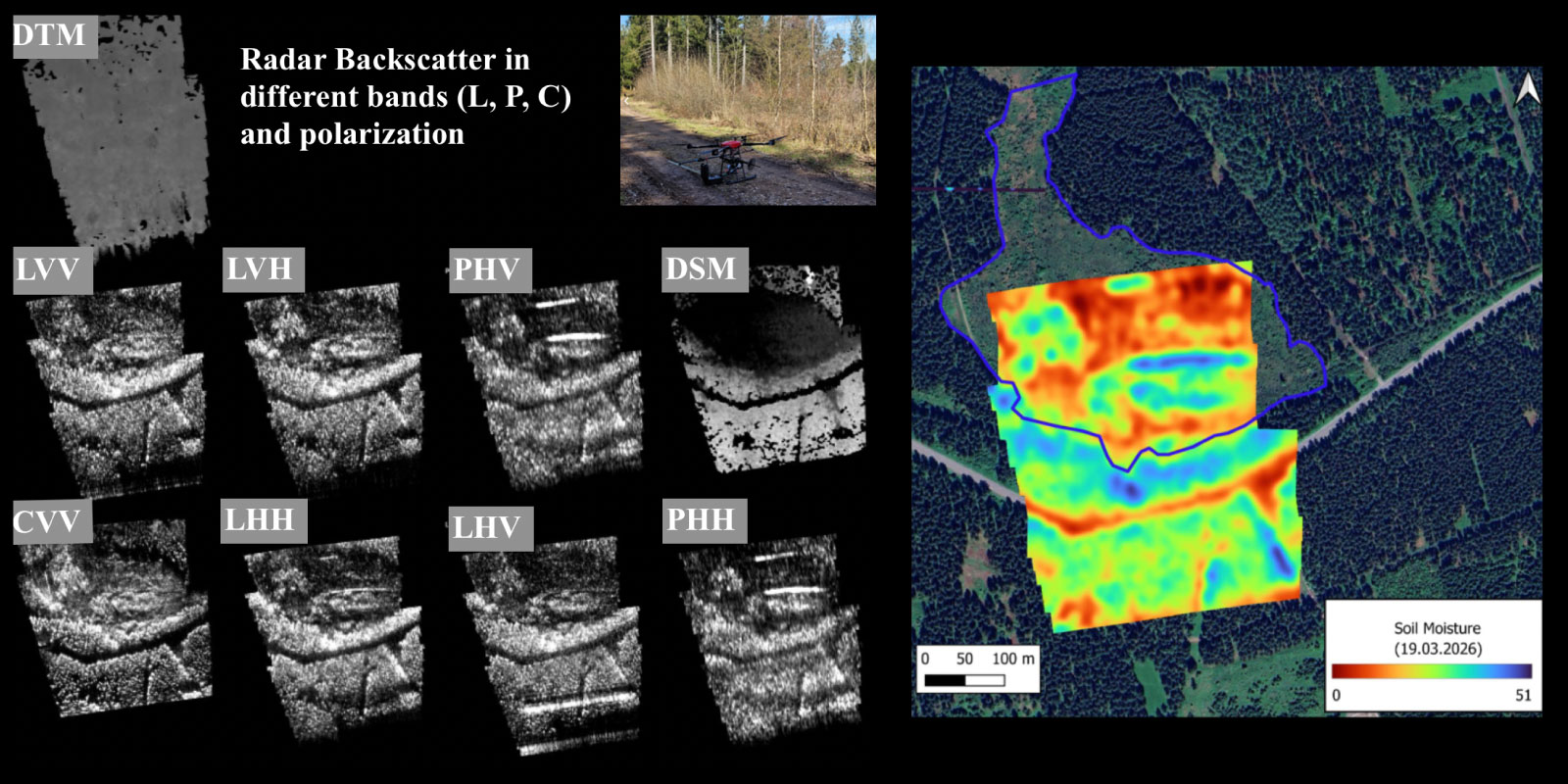
Moisture3D introduces a novel drone-based imaging approach to reconstruct three-dimensional soil moisture distributions below the surface. The project leverages recent advances in radar remote sensing tomography by acquiring multi-angle, multi-frequency synthetic aperture radar (SAR) data in the P-, C- and L-bands. This allows subsurface volumetric features to be resolved, overcoming the limitations of conventional two-dimensional soil moisture maps. Advanced AI methods, including 3D U-Net architectures, are applied to reconstruct and analyze complex SAR datasets. The Helmholtz TERENO observatories, with their long-term environmental monitoring infrastructure and in-situ sensor networks, serve as a validation and testbed. The resulting 3D soil moisture maps support improved hydrological analysis and environmental monitoring.
Other projects
ForestUNLOCK: A multi-modal Multiscale Benchmark Dataset for AI-Driven Boreal Forest Monitoring and Carbon Accounting
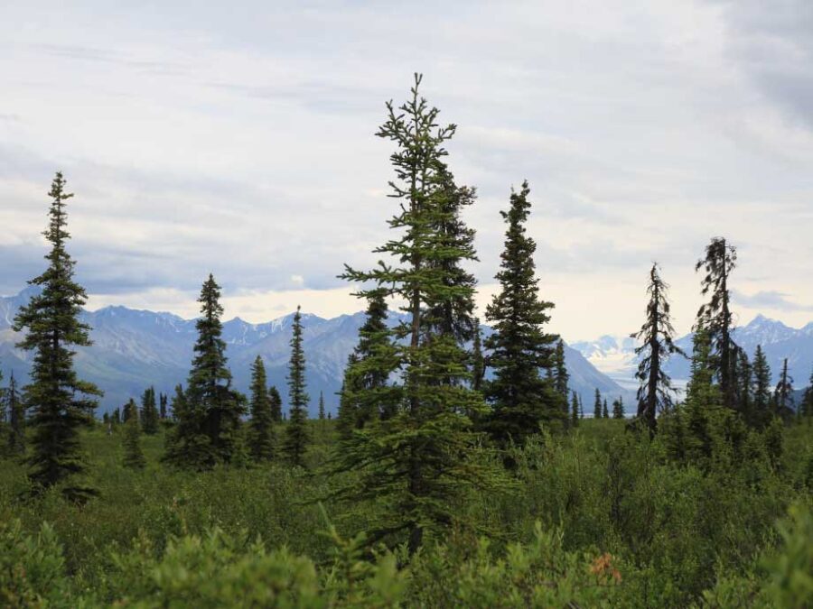
Building the first consistent multi-modal single tree benchmark for forest structure and carbon stock assessments of the northern boreal forest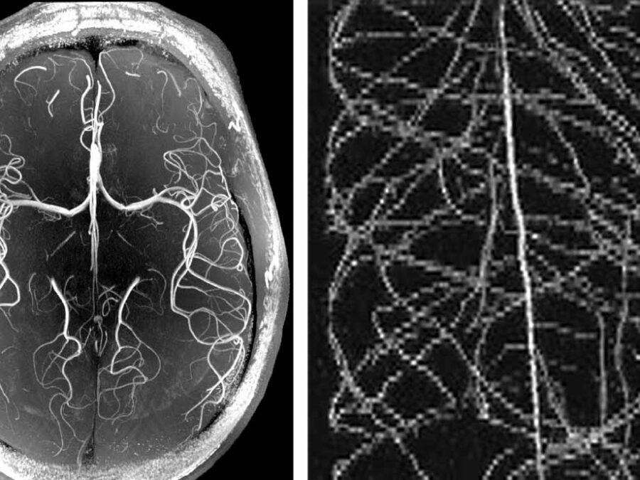
HighLine
High Image Quality for Lines in MRI: From Roots to Angiograms
MR images of roots and vessels are very similar: both display thin, line-like objects. The aim of the project is to increase image quality of both kind of MR data by exploiting their similarity. HighLine aims at obtaining high quality images in reduced scan time to lower patient burden and increase patient and plant throughput by adapting state-of-the-art 3D image enhancement methods, and developing new deep-learning based methods.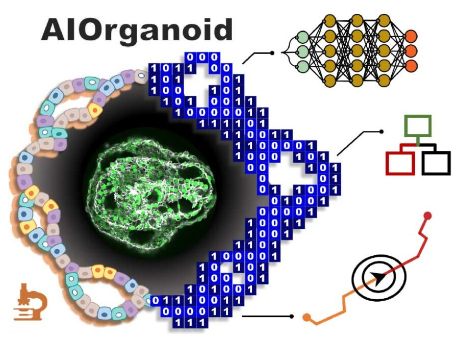
AIOrganoid
Artificial Intelligence Assisted-Imaging for Creating High-yield, High-fidelity Human Lung Organoid
AIOrganoid will apply cutting-edge imaging techniques and develop novel AI-based solutions to facilitate human lung organoid formation with high yield and fidelity, bridging the gap between cell biology and computational imaging.