SIM
Solar Image-based Modelling

The aim of the project is to develop an algorithm by which computers can automatically predict the space weather. This will make use of datasets of solar images that have been captured from space. The method could replace computationally demanding physics-based models and deliver space weather forecasts long before the effects of solar events are felt.
A few years ago, when anyone would ask me why research into space weather was so important, I would answer because there are nearly 1,000 satellites up there in space,” says Prof. Dr. Yuri Shprits of the GFZ German Research Centre for Geosciences. “Now, there are already 3,000 and, by the end of the decade, there are expected to be 10,000.” They are all potentially threatened by hazardous events in near-earth space, such as solar wind or geomagnetic storms. These can cause disruptions or even complete failures of satellite navigation systems, which are becoming increasingly important in connection with autonomous driving, and the same goes for telecommunication technologies and even power grids on earth.
“Currently, solar wind conditions are predicted using physics-based models that are too massive and computationally expensive to be run in real-time,” Shprits explains. The project he and his colleagues are working on aims to change all this. Working from telescopic images of the sun, an artificial intelligence will predict how the space weather will develop after solar flares, for example, have been observed. The novelty is that this system will take detailed data captured from space and analyse it with machine learning algorithms. The aim is to deliver automated forecasts with ample warning, before the effects of processes observed on the sun eventually reach near-earth space. “This way, we avoid having to use the extremely complicated models, with which it can take months to model a solar storm. With machine learning, we want to make it possible for a computer to make its own forecasts automatically from solar images,” Yuri Shprits says. Some satellites could then be switched into “safe mode” and planned manoeuvers or software updates rescheduled as a precaution.
Other projects

MultiSaT4SLOWS
Multi-Satellite imaging for Space-based Landslide Occurrence and Warning Service
In order to detect impending landslides before they occur and to enable reliable emergency mapping after a landslide, the researchers are combining optical data with radar data from satellites. Using machine learning methods, computers will be trained to recognise the tiniest of changes in things like sloping landscape surfaces.
AIOrganoid
Artificial Intelligence Assisted-Imaging for Creating High-yield, High-fidelity Human Lung Organoid
AIOrganoid will apply cutting-edge imaging techniques and develop novel AI-based solutions to facilitate human lung organoid formation with high yield and fidelity, bridging the gap between cell biology and computational imaging.
Fast-EMI
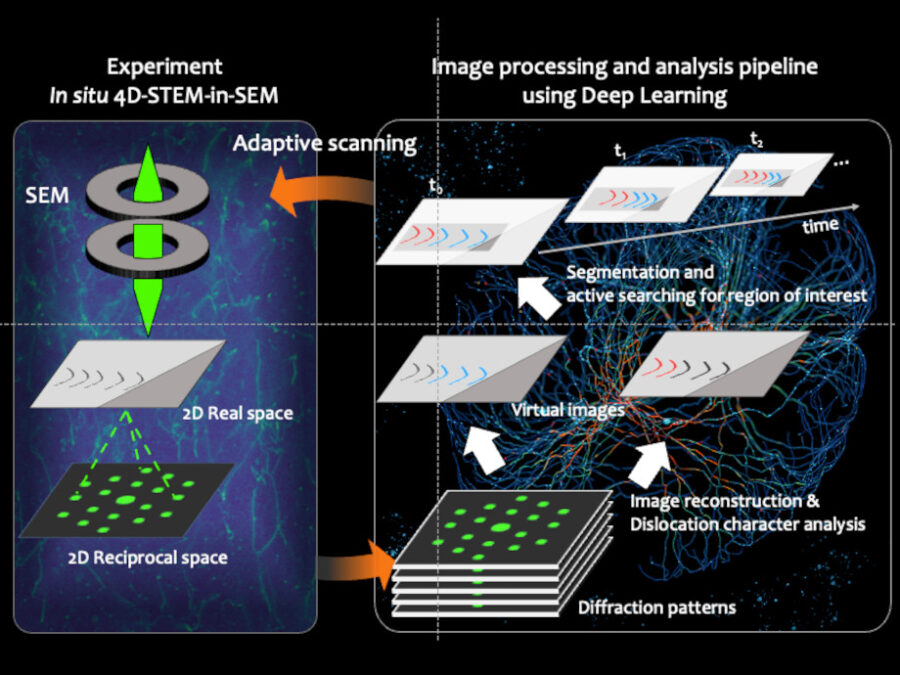
Deep-learning assisted fast in situ 4D electron microscope imaging
A novel imaging approach combining electron microscopy and deep learning has been established. This method enables adaptive tracking of atomic defects, accelerating material development for the energy transition.