DIPLO
Paving the way from in situ plankton image data to a Digital Twin Ocean
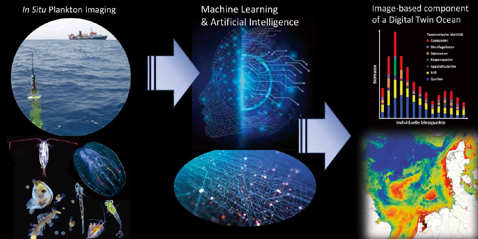
The field of plankton imaging is rapidly growing. So far, a variety of data processing tools are used for each instrument, specifically tailored to its optical properties. This lack of a consistent cross-platform protocol for data analysis impedes the inter-comparability of instruments, and integration into a harmonized global dataset. Here, DIPLO will develop a novel, efficient and user-friendly data processing pipeline to analyze image data independent of the instrument with which raw data was collected, covering the entire data processing task from raw images to ecologically meaningful data, e.g. segmentation of raw images and classification.
This project will combine a suite of modern approaches from computer vision, artificial intelligence and deep learning (e.g. convolutional neural networks). The result will be a consistent and harmonized cross-platform 4-D plankton image database, which is a critical step towards an image-based ecosystem component of a “Digital Twin Ocean”.
Other projects
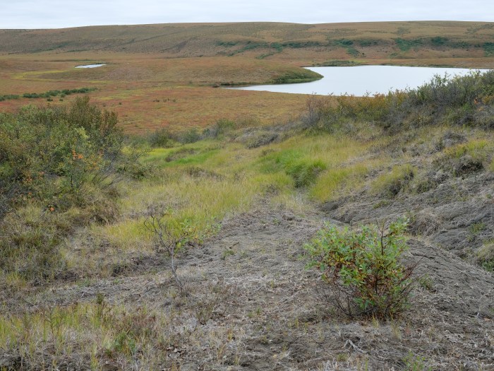
HIT Permafrost
The Hidden Image of Thawing Permafrost
The project aims to develop a method for determining just how extensively thaw processes have already progressed in permafrost regions. The machine learning approach to be developed will be used to analyse radar images from aircraft in order to learn more about the properties of the subsurface permafrost.
SmartPhase
Fast, intelligent 3-D X-ray images for material examination
In order to be able to improve materials, it helps to take a look at their microstructures. This is because valuable information about their properties and behaviour can be found there – for example information about when which ageing processes begin. The aim of this project is to automate and accelerate access to this information with the help of a smart imaging technique.
TerraByte-DNN2Sim
On the trail of the mystery of the laws of calving
Researchers still face a mystery when it comes to the laws by which glaciers calve. This project aims to use satellite imagery, artificial intelligence, mathematical optimisation and a new data processing pipeline to track the movements of glacier fronts in Antarctica to get closer to solving the mystery.